 Dredging Positioning System
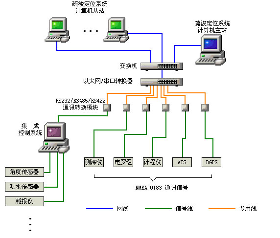
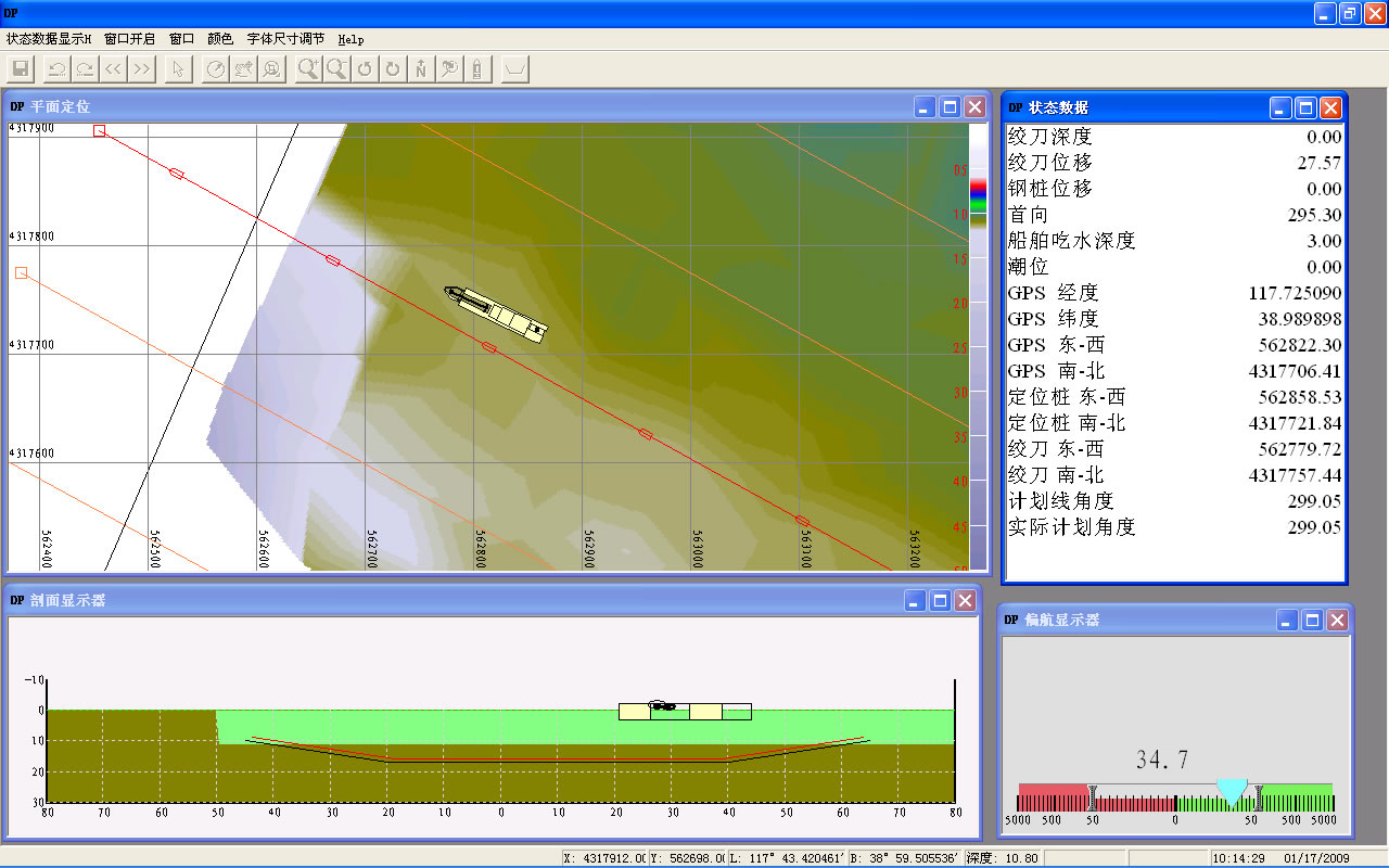
Through RS-485 or RS-422, RS-232 communication interface, read the information of ship's bearing, heading, draft, rake arm or reamer position from DGPS, electric compass, depth sounder, AIS, dredging integrated control system and other peripheral equipment, and display it vividly on the computer screen in real time through visual graphics.
Topological Graph